About Us
ADM Geomatics is the result of a lifelong passion for understanding our planet and the complexities of its form. Rooted in photography, surveying, and digital design, our services reflect a commitment to documenting the built and natural environment through advanced technology.
Architecture, Engineering, Construction, and Surveying are deeply interconnected disciplines. We believe that using the right tools—whether drones, GNSS, or photogrammetry—helps teams navigate complexity, improve communication, and deliver better outcomes.
With over 25 years of experience in surveying and construction, ADM Geomatics offers specialized support on an as-needed basis. We integrate seamlessly with your team, providing high-value expertise at a reasonable cost—no overhead, just results.
What is Geomatics?
Geomatics is the science and art of measuring, modeling, and understanding our physical world. It blends surveying, mapping, photogrammetry, and geospatial analysis to help professionals in architecture, engineering, construction, and land development make informed decisions.
At ADM Geomatics, we see geomatics not just as a technical discipline—but as a way to document and preserve our surroundings. By combining drone technology, GNSS workflows, and digital design, we help teams visualize complexity, improve coordination, and build with confidence.
Current Projects

Nueces Condos
Austin, Texas

Williamson County CMF
Georgetown, Texas
CR201 Improvements
Liberty Hill, Texas

973 Industrial
Taylor, Texas
actionable data
SERVICES WE OFFER:
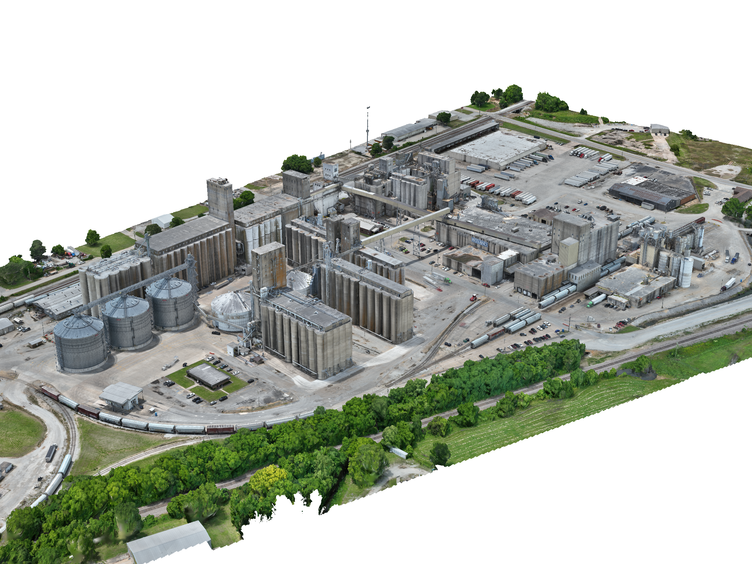
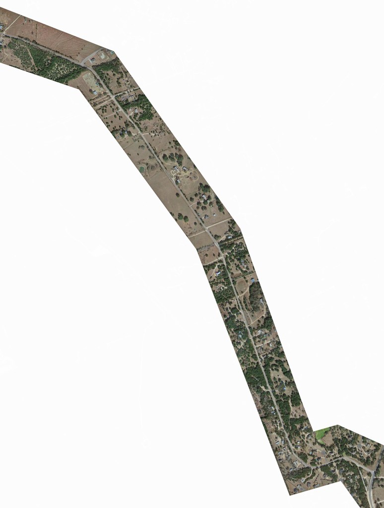
ADM Geomatics offers services to the AEC industry, surveyors, conservation organizations, and developers. Our specialty lies in GNSS workflows, machine control, site modeling, and drone-based data collection.
We prioritize honest communication and strive to exceed expectations—not just in accuracy, but in how energized and confident our clients feel about the data we deliver.
Our primary services involve the use of drones and GNSS equipment to collect massive amounts of data. We then extract and present that data clearly using specialized software—delivering exactly what our clients need, the first time… and then some.
Embark on a journey of discovery with us, where every capture opens a new way of seeing your project.
- Construction support and GCP control networks
- Design CAD Work
- CAD TIN files
- GNSS Machine Control Models
- PPK processing & Image tagging
- High-resolution site progress aerials and videos
- 360° panoramas & tours
- Orthomosaic site maps (as low as 0.5 in/pixel)
- Aligned CAD and/or PDF plan overlays
- Topographic contour maps
- DSM and DTM point clouds
- Excavation cut/fill reports
- CAD infrastructure as-built 3D planimetrics
- Point cloud editing, classification and DEM creation
- Textured meshes
- Photogrammetry processing w/ Agisoft Cloud hosting (first project under 1,000 images is free)
The Bottom Line
“I believe there are no coincidences and every person we meet is an opportunity to provide exceptional service through kindness, patience and perseverance. Thank you for your support!”
— Michael Lambert
President, Operator for ADM Geomatics
Part 107 Certificated sUAS Pilot
